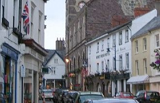
Abergavenny
Is this your URP?
Claim listing is the best way to manage and protect your URP
Click to enlarge image for saving
The Church of St Mary, in Monk Street, was originally the chapel of an 11th century Benedictine priory.
Only the tithe barn and prior's house remain of the priory buildings, but the church has traces of medieval architecture and contains some 14th century choir stalls, tombs dating from the 13th to 17th centuries and a Norman font.
The ruins of an 11th century castle are a reminder of Abergavenny's part in Welsh history.
It was the scene of a massacre in 1175 when the Norman William de Braose gained a savage revenge against the Welsh who had murdered his uncle.
He invited the local chieftains to a Christmas dinner and, while they were eating, had them slaughtered.
The castle was destroyed in 1645 on the orders of Charles I to prevent Cromwell\'s forces from using it.
Of the hills that encircle the town the following are good vantage points.
To the south is Blorenge at 1,834ft, to the north is the Sugar Loaf at 1,955ft and to the northeast is Skirrid Fawr at 1,596ft.


Abergavenny
Landmarks